Electronic Navigation
Blue Water Sailing, January 2003
After six years and 47,000 miles while circumnavigating the world, I have evolved to an electronic charting system that not only works, but also is one in which I have complete trust and confidence. That is the key for me. The navigation system you use must be one you trust, in fact, one in which you will trust your life and boat.
Of fundamental concern is the quality of the charts that you use. For electronic charts the first decision is vector or raster charts. Even after considering the touted advantages of vector charts, primarily smaller file size and the ability to provide different layers, I still don't trust them. They are an interpretation by someone of a paper chart of undisclosed origin. Layering means that you will not have all the data at every level, some of which might be critical. They are also untried over many years and are not kept up to date with registered changes. A friend of mine checked one of the most popular electronic vector charts of an island he knew well in the Caribbean and to his horror he found that a reef was not even shown on the chart. I have compared vector charts to my system in many areas of the world and nearly every time they lack the detail of a paper chart and the detail necessary for safe navigation.
Thus, in my case, I have chosen to use raster charts, which are direct copies of paper charts on the computer. The issue then is which paper charts to use. I have found that British Admiralty charts from the United Kingdom Hydrographic Office (UKHO) are the best overall, and they cover nearly every cruising area in the world. They use colors that make them highly readable, they are very detailed, the depths are frequent in the required areas, they provide land contours, the paper is thicker and they are generally uniform in size. As a result I use Admiralty paper charts nearly exclusively, except in specialized situations. One example was the Yasawa islands west of Fiji. In that case the best paper chart was from Fiji and I determined my waypoints from it.
The UKHO offers nearly all of their charts in electronic form, called ARCS (Admiralty Raster Chart Service) charts. These are exact duplicates of the paper charts, only on your computer. (See their web site, www.ukho.gov.uk for more information.) The chart numbers are the same, and all the chart is visible including all the notes, tide data and survey data. Thus you can generally find out when and by what method (lead line, swept wire, sonar, etc.) the soundings were made. The charts are contained on CD's and what you buy is a permit to open the chart purchased. The permit can be obtained via E-mail from an Admiralty chart supplier. Thus, even in remote areas you can obtain additional ARCS charts as long as you have E-mail capability. Besides the basic chart CDs, which are by region, BA issues a weekly update. When you purchase a chart you also get the latest update so the purchased chart is up to date. You can also purchase the update weekly or annually. Because of the update ability and because they are exact duplicates of the paper charts, ARCS charts are the only electronic charts that are legally accepted as proper navigation charts for large ships. In fact, I have found that recently purchased electronic charts are more up to date than recently purchased paper charts.
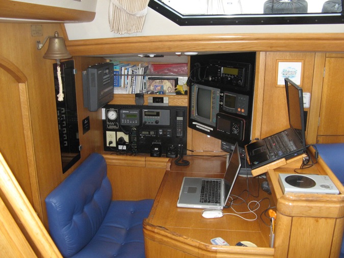
To use ARCS charts requires navigation software that is set up for ARCS, I use MaxSea, as I use a Macintosh Titanium G4 power book as my navigation computer. MaxSea also makes a PC version that has ARCS capability. Further, there are several other navigation programs that can display ARCS charts, so there are alternatives. ARCS charts require registration with BA and the use of a dongle with the computer.
To provide a degree of security I keep the electronic charts separate from the autopilot. Thus, the boat is steered by the autopilot with data from waypoints entered into the GPS and is not dependent on the charting system. The computer receives input from the GPS and plots the present position, and I retain the tracks of all our sailing on the computer for future reference. For all trips, whether 2 miles or 3,000 miles, I develop a passage plan in advance. This consists all of the waypoints, courses and distances for the passage. I create this electronically on the computer, as it is easier, faster and more accurate. However, I keep the passage plan on paper as well as enter it in the GPS. I also compare the courses and distance that the GPS computes from the waypoints to that computed by the charting program to assure the waypoints and courses are correct before we depart.
The final major concern regarding charts, and this applies to paper charts as well as electronic charts, is how a specific chart relates to GPS positions. The UKHO is working to adjust all charts to WGS 84 datum, but many are not there yet. Some charts give the amount of latitude and longitude to correct for, and you can enter this into the GPS. My greatest concern involves landfall, when you have no prior knowledge as to the alignment of the chart. Thus, I set the landfall waypoint far away from any dangers. This is followed by subsequent waypoints that are progressively closer to known objects. When we have visual or radar confirmation of our position I determine how accurate our position is on the chart. We then proceed accordingly relative to the chart position. Our most notable concern in this regard was the island nation of Niue. Before leaving Rarotonga we were informed that Niue could be up to 2 miles SSW of the chart position. In fact, when we got there, it was exactly where the Admiralty chart said it should be. I had set the landfall waypoint more than 3 miles south of the island just in case.
When on a passage we record our position, course, speed, and other critical factors on paper every two hours so that we could proceed by dead reckoning if the electronics failed (it never has). To minimize the cost of charts, electronic and paper, I use a strategy of selecting the most critical ones rather than a complete duplicate set. For example, if the pilot book for a specific area is quite good, especially in terms of harbor approaches and entrances, then I don't purchase detailed paper charts. Instead I get large-scale paper charts of the area to permit route planning to within the detail of the pilot book. For electronic charts, however, I get the most detailed ones available for the area we are sailing and for all ports that we might enter (including backup ports). I only get large-scale electronic charts so that I have continuous coverage from start to finish. This strategy proved itself when we were transiting the Red Sea and we decided to divert to Port Sudan because the winds turned against us. Even though we had not intended to go into Port Sudan, I had a detailed ARCS chart of the port. As we approached we were hit by a sand storm, and visibility dropped to less than a tenth of a mile. To enter, we had to go between reefs only a few hundred yards apart. As these reefs are under water the radar was of no help. We had to rely on electronic navigation. When we finally could see we were right in the middle of the entrance channel.
Using ARCS charts this way gives the same navigating accuracy as paper charts. Further, electronic chart plotting is automatic and continuous. This is especially comforting in high tidal areas where it is easy to get off course. Finally, changing routes and establishing new waypoints is far easier and quicker using the mouse rather than dividers. It is also far more accurate and less prone to error, especially when the boat is bouncing about.
This electronic/paper chart strategy is fairly expensive, but it provides superior results. In general, with very few exceptions, electronic charting has proven to be very accurate all around the world. As there are exceptions, in tight quarters visual observation is the only sure method. But we have been able to navigate electronically in extremely difficult situations. In Chesapeake Bay we got caught in thick fog. Steering by autopilot based on our pre calculated passage plan, we monitored our position by the electronic chart, then by radar returns on buoys, then by visual sighting of the buoys when they were within 50 feet. The accuracy is generally good enough to not only remain in the channel, but to stay to one side. This also means that buoy positions should never be used as waypoints. Actually, our greatest concern was the possibility of other ships and we took appropriate actions to see and be seen on radar and by sound.
This strategy makes electronic charts the primary navigation tool and paper charts as backup. I believe it is superior to former methods and the best system currently available. We have proven it around the world, in many situations, and with many charts.